AND interface
AND WMSclient
Optional client plug-in for the AND SystemSolution providing the user access to external map sources: OpenStreetMap™, Google Maps™, Esri™, MapInfo™ etc.

Opens the door to literally any map source
AND WMSclient enables the user to query maps via WMS, to fetch them from any map server with WMS interface, and to display them as a background layer in AND GIsArea projects. WMS – Web Map Service Interface Standard (Open Geospatial Consortium) – provides a simple HTTP interface for requesting geo-registered map images from one or more distributed geospatial databases.
A WMS request defines the geographic layer(s) and area of interest to be processed. The response to the request is a geo-referenced map image (returned as JPEG, PNG, etc.) that can be displayed in an application. The interface also supports the ability to specify whether the returned images should be transparent so that layers from multiple servers can be combined if required. The level of transparency can also be adjusted.
AND WMSclient administers information using a WMS Document (stored on the AND SmartServer). This contains a list of WMS data sources, each describing the WMS server and a list of the WMS layers to be used in queries. As a result, the querying software function receives a map for each data source listed. These maps are joined to form an overall map. Separate display options are available for each data source.

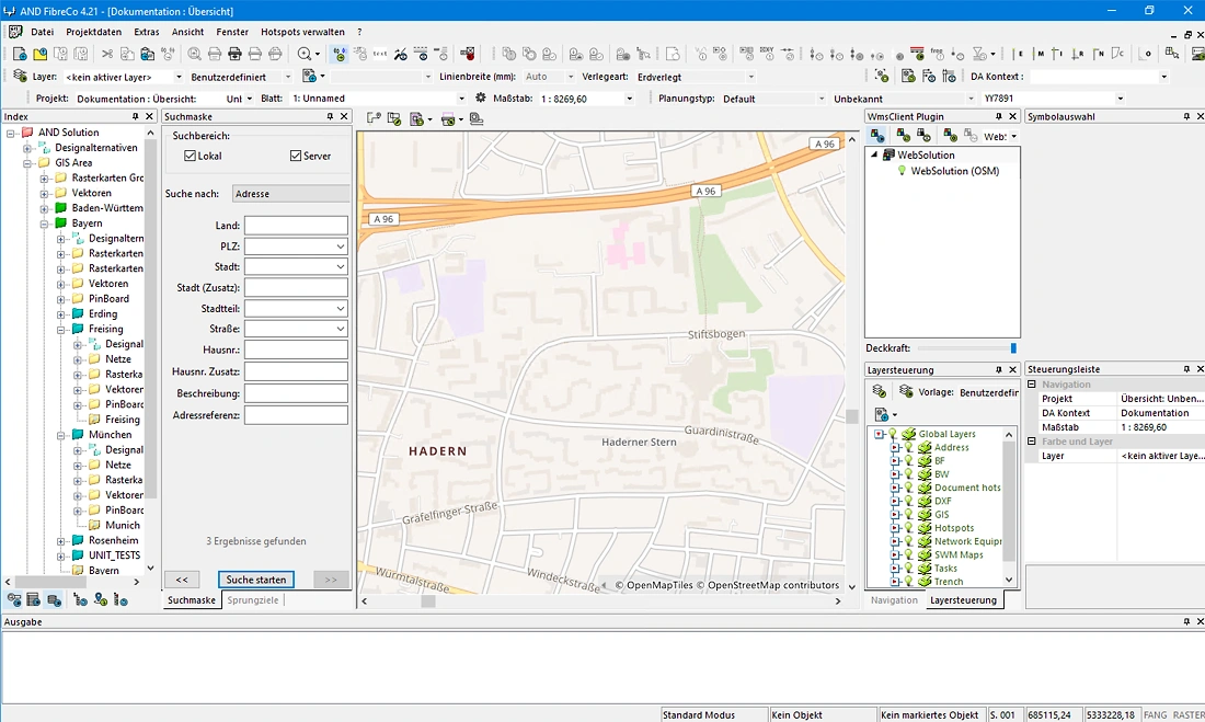
WMS Documents can be embedded in AND projects allowing the previously used configuration to be restored when the AND project is loaded next time. This is the case even if the WMS Documents used at the time of saving are no longer separately available.
Users quickly become used to fast response times when working with maps within AND. The ability to manage maps and data storage efficiently and fast is especially important during the design of access networks in densely populated areas. To ensure adequate performance when sourcing maps externally we recommend the usage of an Open Source caching manager, e.g. MapProxy™, which can also re-project map files.
Pre-planning with AND WebSolution
Define routes and costs early, without specialist knowledge and without installation.